SoilXplorer soil sensor

Contactless soil sensor for soil profile mapping and variable soil tillage.

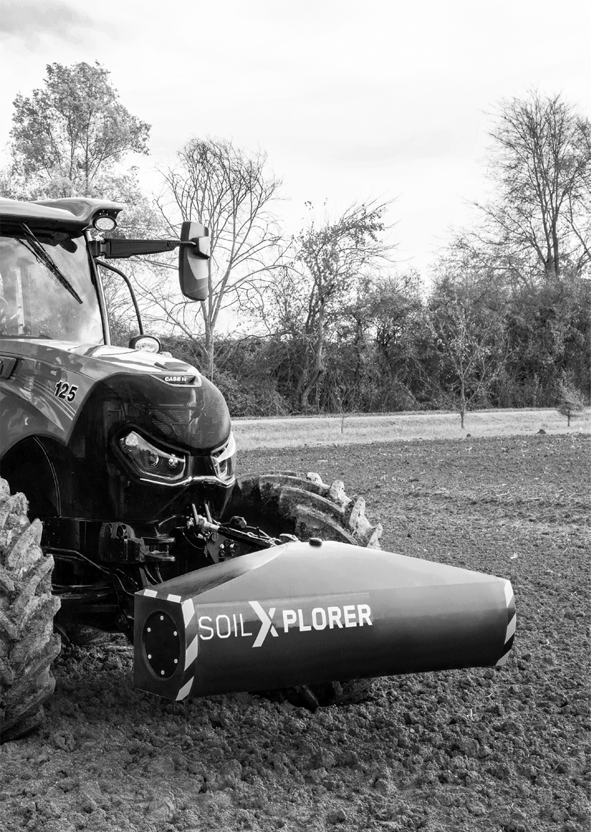
Soil-x-01 Look under the surface

Precision farming is the key to increasing your productivity. AG XTEND's new SoilXplorer soil sensor is part of a new autonomous soil conductivity measurement system. Acquires all the data you need to optimize land management on land, such as soil structure, relative water content, nutrient supply, and soil compaction.

As the SoilXplorer does not require direct contact with the soil, it is therefore independent of weather conditions and vegetation conditions. In addition, this sensor is able to control the tillage depth in real time and change the sowing rate when setting up new stands.

How does the sensor work?

The SoilXplorer soil sensor sends an electromagnetic signal to the soil and the four coils measure the conductivity of the soil at four different depths. When the sensor is 40 cm above the ground, the layers are: 0-25 cm, 15-60 cm, 55-95 cm, and 85-115 cm. Based on the agronomic model, the system calculates soil structure, relative water content, nutrients and soil compaction.

In conjunction with a GPS receiver, the system can record and map soil irregularities at all four depths. Of course, the emitted electromagnetic signals have no effect on the vegetation and life of organisms under the soil surface.


SOFTWARE SOILXTEND

Scans the ground on the fly!

SoilXtend software allows you to convert raw data from the SoilXplorer sensor into valuable files for your farm management information system (FMIS).

Main function:

  •      Soil profile mapping to optimize application maps ensures targeted soil and zone sampling
  •      Interface depth (D2I) to understand the thickness of your upper soil layer
  •      Mapping the soil structure to document leased land at the beginning and at the end of the contract
  •      Sensing soil compaction for different soil tillage at different depths
  •      Determination of relative water content for improvement


The following map types are available:

  •      Relative water content (rWTC)
  •      Interface Depth (D2I)
  •      Structure and type of soil on the plot
  •      Maps for variable tillage
Soil-x-03


SEEDXCONTROL

VORTEILE FÜR BAUERN:

  •     Berührungsloser Bodensensor, um Informationen über den Zustand des Bodens auf dem Grundstück zu erhalten
  • Besseres Verständnis von Boden und Bodenprofil
  • Energieeinsparung (Kraftstoff)
  • Erkennen und Verstehen von Bodenungleichheiten
  • Optimierte Saatmenge je nach Bodenbeschaffenheit
  • Erstellung von Rezeptkarten für bestimmte Arbeitsvorgänge (Düngung, Bodenbearbeitung und Aussaat
  • Optimierte Applikationskarten erstellen
  • Nachhaltige Unterstützung und Verbesserung der Bodenstruktur
  • Management der Bodenfeuchteüberwachung
  • Lösung der Bodenverdichtung durch variable Bodenbehandlung (Unterstützung des Wurzelsystems und der Regenwurmaktivität)
  • Effizientere Bodenbearbeitung


Share |